
Feature available on Personal and Professional plans
Current limits
Personal Plan - up to 1,000 (thousand) addresses per month
Professional Plan - up to 10,000 (ten thousand) addresses per month
🌎 📍
With this feature you will be able to enter address bases as points on the map:
- Own stores
- Customers
- Competing networks
Understand how Mapping happens
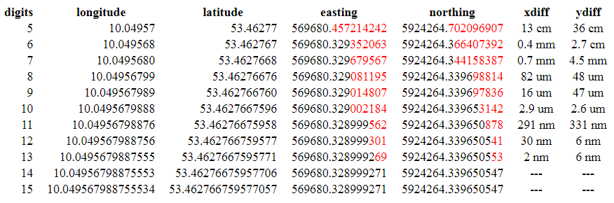
Our planet was cut into quadrants by horizontal lines, parallels, or latitude and vertical lines, meridians, or longitude.
Lat and Long for the intimate ones.
.png)
This cutout simplifies the identification of points on the Earth's surface and it is with it that we are going to work.
.png)
.gif)
⚠️
The process is subtle, so be careful to avoid errors.
For everything to go well you must have a complete list of address data to map.
There are two possible paths:
- You have a full address base
- Do you have a base that has already gone through the mapping process
.png)
1 - Base not yet mapped
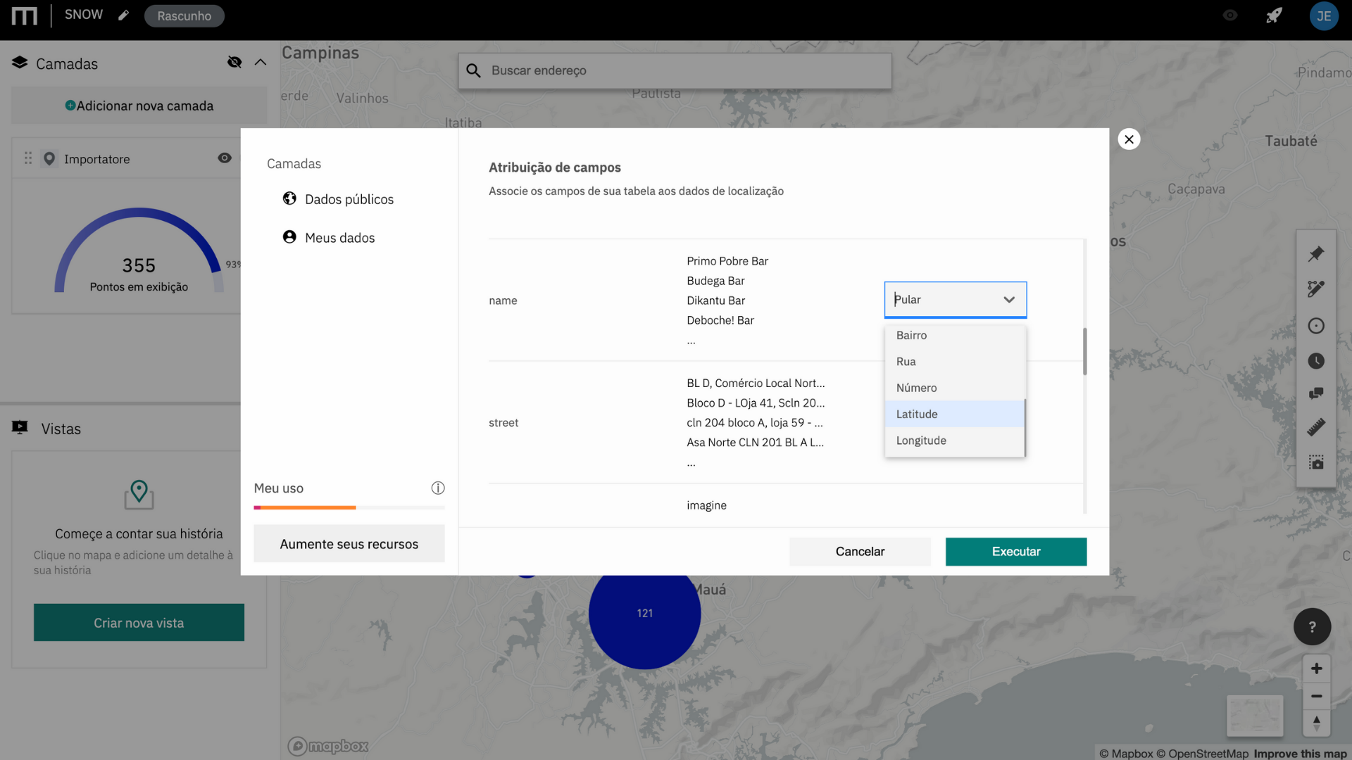
In the first option all address details are mandatory (in black) and the latitude and longitude (geographical coordinates) are optional (green), while fields that are not related to the mapping can be ignored (Jump option)
Required fields:
- Name
- Street
- Number
- District
- Postal Code
- town
- State
- Country
2 - Pre-mapped base
In the second option, the base has already undergone a mapping process in another system, also known as geocoding, so the geographical coordinates are filled in in their decimal format.
.png)
Even on already mapped bases, the fields of Name and Street remain mandatory (in black) to identify the point on the map.
Required fields:
- Name
- Street
- Latitude
- Longitude
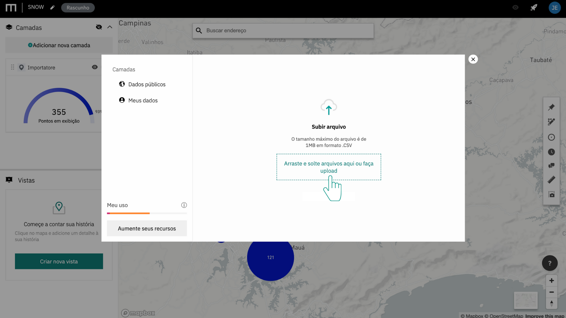
This table with addresses or geographical coordinates must be exported from Excel, Google Sheets or any other spreadsheet system, in CSV format (Comma Separated Values or Comma Separated Values).
In practice, the spreadsheet will be transformed into a text document, where commas play the role of columns.
⚠️
CSV is the most commonly used format for importing tables, but it's not error-free.
Mapfry is prepared to recognize the most common patterns.
If the field assignment step presents a result like the one below, you are probably trying to import a CSV file in a format that does not comply with the standards currently recognized by the platform.
As a contour path, we recommend that you open your file in Google Drive as a Google Sheets sheet and download it as a CSV from there.
.jpeg)
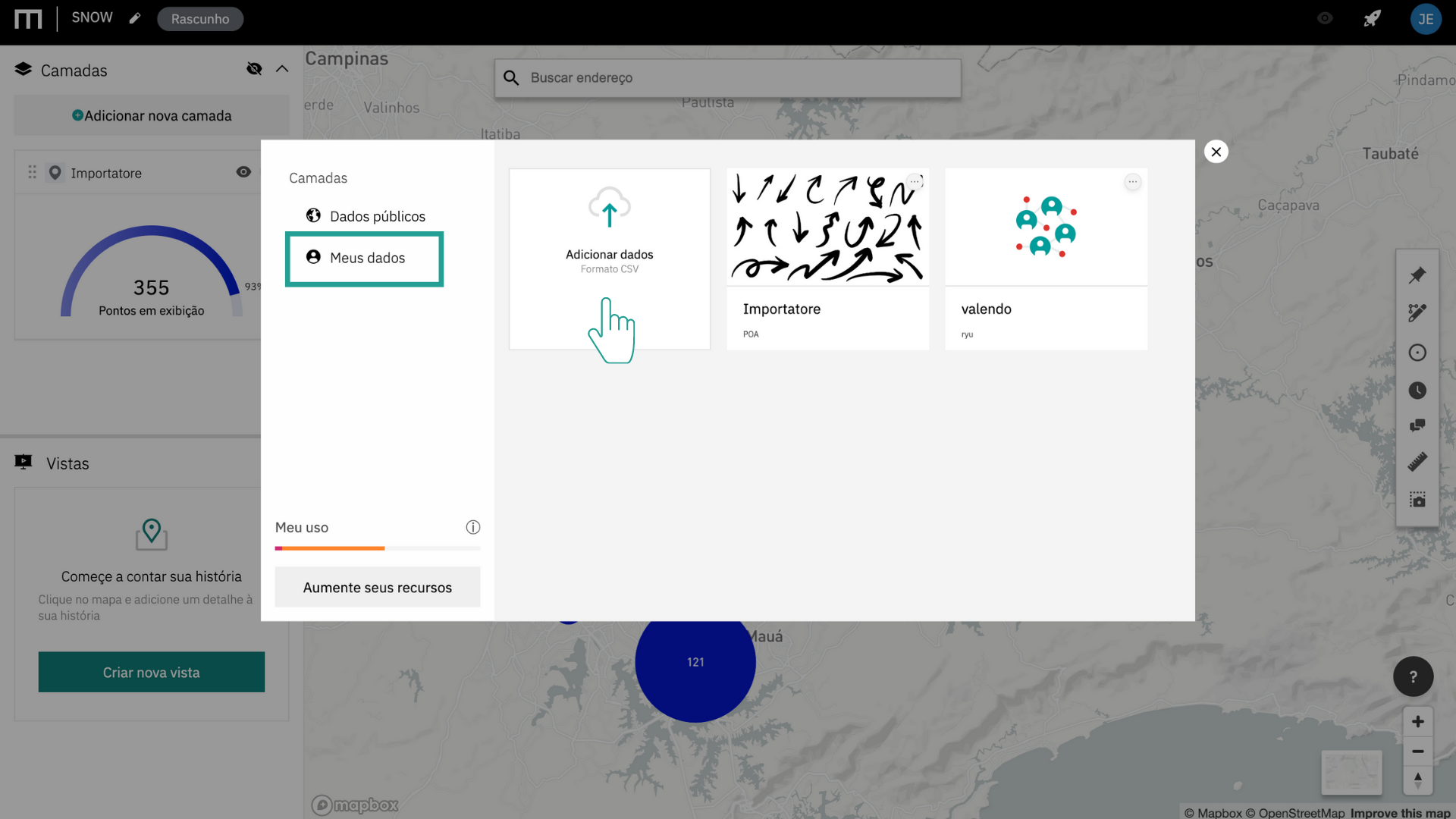
Importing databases to the Mapfry platform
You now find the “My Data” option in the Layers modal:
Click “Add data”
Select the CSV file that will be imported
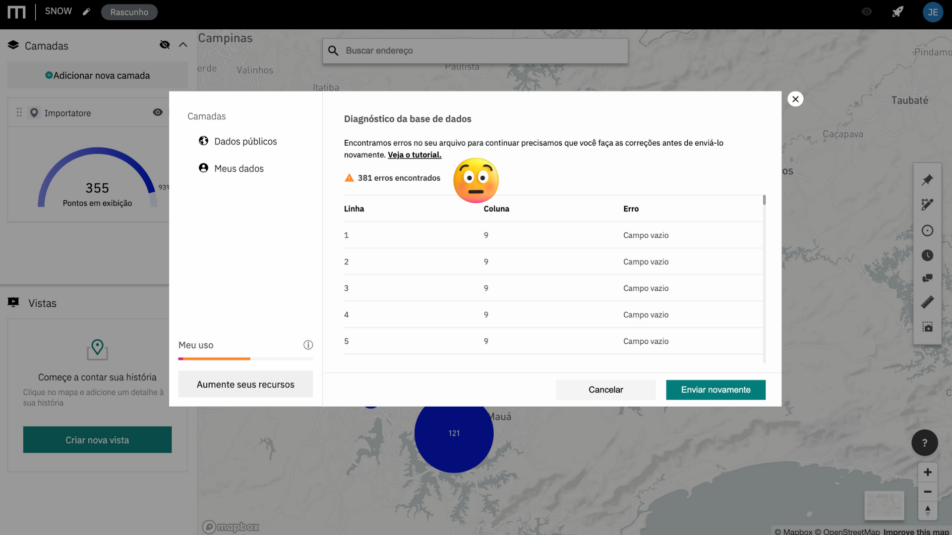
The system will perform a diagnosis for errors in your file
Errors make it impossible to map data and must be corrected or deleted from the original table.
Indicate what addressing information each column refers to
This information will be used to assign the points to the map.
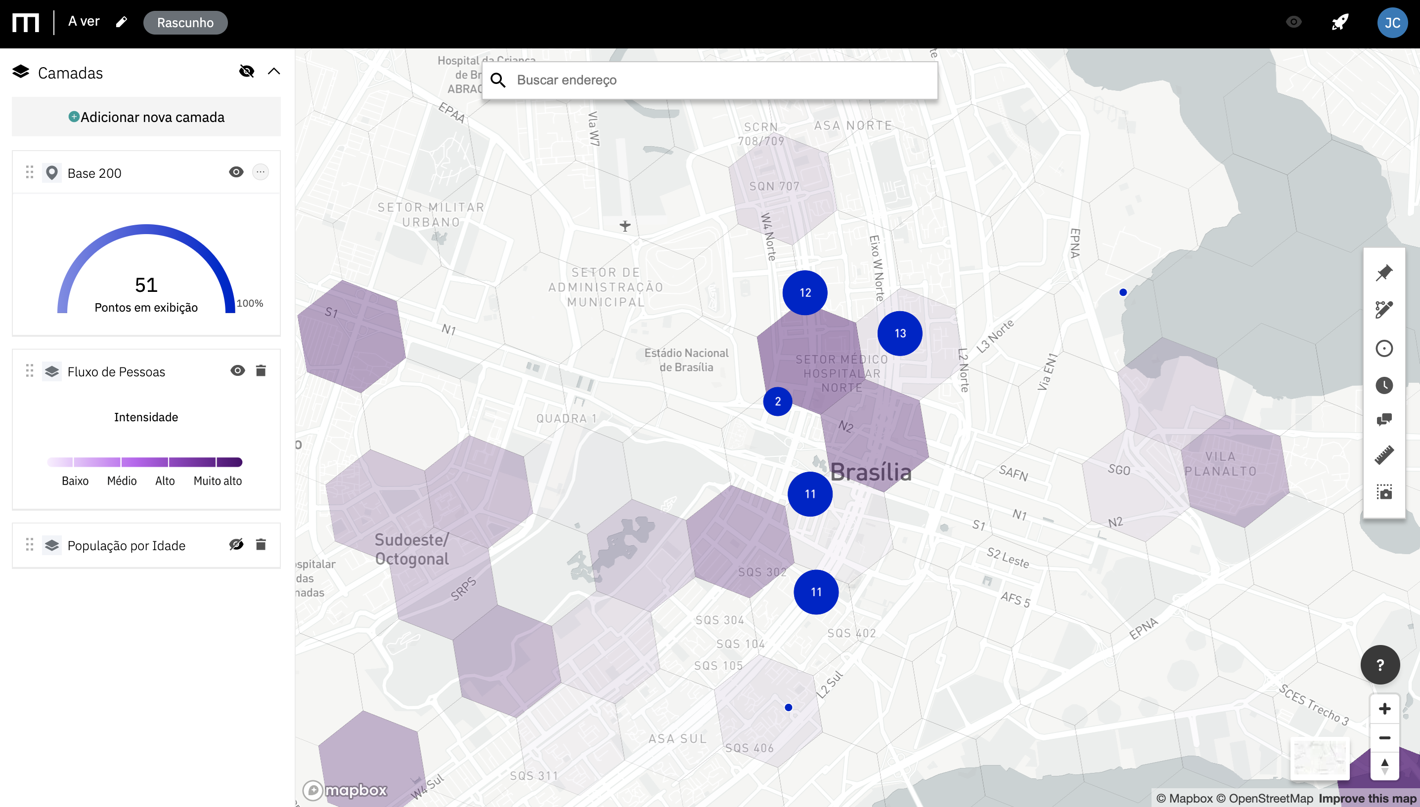
Voilà
Your data is ready to be viewed on the map!
.png)
It's seeing is believing
Now you have the privileged view of your points in contrast to market data.
.gif)
⚠️
Questions, suggestions, and errors: hello@mapfry.com